Jump to navigation
NR Colorado Department of Natural Resources
Pages
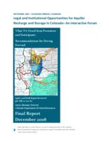
- Legal and institutional opportunities for aquifer recharge and storage in Colorado, an interactive forum, September 2007, Colorado Springs, Colorado : what we heard from presenters and par
- Lesser prairie-chicken
- Letter of R.D. George, transmitting economic maps : prepared under his direction of the region served and to be served by the Denver & Salt Lake Railroad (Moffat Road) and transmitting a statement prepared by him about the coal, oil shale, hydrocarbon and
- Licensed coal mines in Colorado
- Life at the top : Colorado wildlife above timberline
- Limestone-Graveyard Creeks Watershed, Bent County, Colorado, Prowers County, Colorado watershed plan and environmental assessment
- Linking hunting access and chronic wasting disease : a case study from northeastern Colorado
- Lions, ferrets, & bears : a guide to the mammals of Colorado
- Literature review of the historic distribution of the Rocky Mountain goat (Oreamnos americanus) in Colorado
- Little Thompson watershed restoration master plan
- Living streambanks : a manual of bioengineering treatments for Colorado streams

- Living with bears
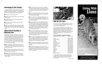
- Living with lions
- Living with wolves : how to avoid wildlife conflicts
- Local pre-disaster flood hazard mitigation plan
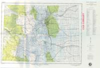
- Location map of drill holes used for coal evaluation in the Denver and Cheyenne Basins, Colorado
- Location of lode and placer mining claims in Colorado
- Logan mountain deer management plan data analysis unit D-41, game management units 31 & 32
- Long range plan, 1994-1998
- Long range plan, 1994-1999
Pages
