Jump to navigation
NR Colorado Department of Natural Resources
Pages
- General locations of lynx (lynx canadensis) reintroduced to southwestern Colorado from February 4, 1999 through February 1, 2005 : report for the Colorado Division of Wildlife
- Generalized geology of Colorado
- Genetic purity assessment of select Colorado River cutthroat trout populations in northwest Colorado
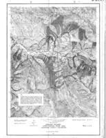
- Genetic stratigraphy, coal occurrence, and regional cross section of the Williams Fork Formation, Mesaverde Group, Piceance Basin, northwestern Colorado
- Geologic and hydrologic controls on coalbed methane, Sand Wash Basin, Colorado and Wyoming
- Geologic aspects, soils and related foundation problems : Denver Metropolitan Area, Colorado
- Geologic control of supply and quality of water in the mountainous part of Jefferson County, Colorado
- Geologic factors in land-use planning, House bill 1041 : proceedings, Governor's Third Conference on Environmental Geology, Aspen, Colorado, September 25-26, 1975
- Geologic hazards avoidance or mitigation : a comprehensive guide to state statutes, land use issues, and professional practice in Colorado
- Geologic hazards in Douglas County, Colorado
- Geologic hazards in the Big Thompson Canyon area, Larimer County, Colorado

- Geologic hazards in the Crested Butte-Gunnison area, Gunnison County, Colorado
- Geologic hazards of the Glenwood Springs metropolitan area, Garfield County, Colorado
- Geologic hazards, Hotchkiss-Paonia Reservoir area, Delta and Gunnison Counties, Colorado
- Geologic hazards, Upper Crystal River area, Gunnison County, Colorado
- Geologic hazards, land-use laws, and professional standards of practice in Colorado
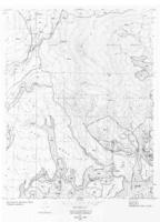
- Geologic map Routt County, Colorado
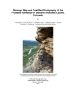
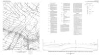
- Geologic map and coal bed stratigraphy of the Fruitland formation in western Archuleta County, Colorado
- Geologic map and coal measures of the Axial quadrangle, Moffat and Rio Blanco counties, Colorado
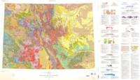
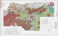
- Geologic map of Colorado
Pages
